Leyden Street
Leyden Street is easy to overlook among Plymouth’s better-known landmarks. It is not lined with houses preserved from 1620, nor does it resemble a reconstructed colonial village. Modern businesses, homes, vehicles, and signs now occupy the street. Its importance lies beneath those later changes: the route itself follows the first street laid out by the Mayflower settlers as they began building Plymouth Colony during the winter of 1620–1621.
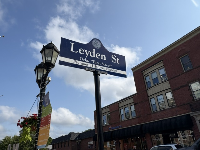
The street was planned to connect the harbor with the hill rising behind the settlement. From the waterfront, it climbed westward toward what is now Town Square and Burial Hill. This arrangement was practical. The harbor provided access to the Mayflower and the sea, Town Brook supplied fresh water, and the hill offered a commanding view of the surrounding area. The settlement’s principal street connected these essential features and gave the new community its basic shape.
The settlers began constructing their first buildings along this route before Christmas in 1620. Lots were assigned on both sides of the street, and families built small timber houses with thatched roofs. These were not the large, carefully preserved colonial homes that later came to represent New England. They were modest shelters constructed quickly during a dangerous winter by people who had already endured a long Atlantic crossing. William Bradford, William Brewster, physician Samuel Fuller, Peter Browne, and other early settlers were associated with properties along the street.
At the lower end stood the Common House, the first building completed by the settlers. It provided shared shelter, storage, and a place for the community to meet. Plymouth Colony’s first recorded court meeting was held there in the spring of 1621. In those earliest months, the street was not simply a passage between buildings. It was the center of a settlement where civil government, religious life, family survival, and daily work were still closely connected.
In 1622, the settlers constructed a fort at the top of the hill. Its lower level served as a meetinghouse where the community gathered for worship and public business, while cannon placed above helped defend the settlement. The broad street running between the harbor and the fort created a direct line through the center of Plymouth. An early description called it a street approximately 800 feet long leading down the hill toward the sea.
The road did not initially carry the name Leyden Street. Early records referred to it simply as “the Street,” as well as First Street, Great Street, or Broad Street. In 1823, it was officially named Leyden Street in honor of Leiden, the Dutch city where many members of the Separatist congregation had lived before sailing to America. They had moved there in 1609 after leaving England in search of greater religious freedom. The older spelling “Leyden” was commonly used in English and was preserved in the Plymouth street name.
None of the original seventeenth-century houses survives. Fire, weather, rebuilding, changing architectural styles, and the continued growth of Plymouth gradually transformed both sides of the street. The buildings seen today largely belong to much later periods. Yet the street continued to be occupied and used as the town developed around it, making it one of the oldest continuously inhabited streets in British North America.
Its survival also preserves the original geography of the settlement. From the lower end, one can still understand the connection to the harbor where the Mayflower lay anchored. Looking uphill, the street still leads toward Town Square and Burial Hill, where the colonists established their fort, meeting place, and burial ground. Although nearly every structure has changed, the relationship among the waterfront, the street, and the hill remains visible.
Leyden Street tells a different kind of historical story from Plymouth Rock, the Mayflower II, or the National Monument to the Forefathers. Its significance is not contained within a single monument. It is found in the alignment of an ordinary street that has remained part of daily life for more than four centuries. People still walk, drive, work, shop, and live along the same route that gave the original Plymouth settlement its form.
Read More
Read More From Nancy
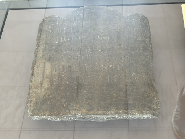
Mary Cooke Thompson Gravestone
Among the artifacts at Pilgrim Hall Museum is this early New England gravestone for Mary Cooke Thompson, a woman with a direct connection to one of the Mayflower families. Mary was the daughter of Mayflower passenger Francis Cooke and his wife, Hester Mahieu. Mary was born in Leiden in the Netherlands, where the English Separatist […]
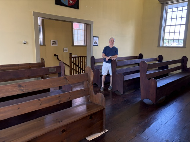
Spectator Seating
Along the sides and rear of the courtroom in Plymouth’s 1749 Court House are rows of simple wooden benches where members of the public could sit and watch the proceedings. Marty standing among them gives a good sense of just how intimate this courtroom would have been. There was very little distance between the spectators […]
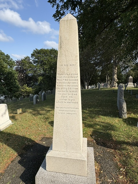
Governor William Bradford Memorial
This granite obelisk on Burial Hill honors William Bradford, one of the Mayflower passengers and a central figure in the establishment of Plymouth Colony. After Governor John Carver died in 1621, Bradford was chosen to lead the struggling colony. He continued to serve as governor for most of the years until his death in 1657, […]