Glacial Potholes
At the base of Salmon Falls in Shelburne Falls, the Deerfield River flows through a landscape of smooth stone ledges and rounded hollows. Known as the Glacial Potholes, these formations reveal how moving water can gradually reshape even hard bedrock.
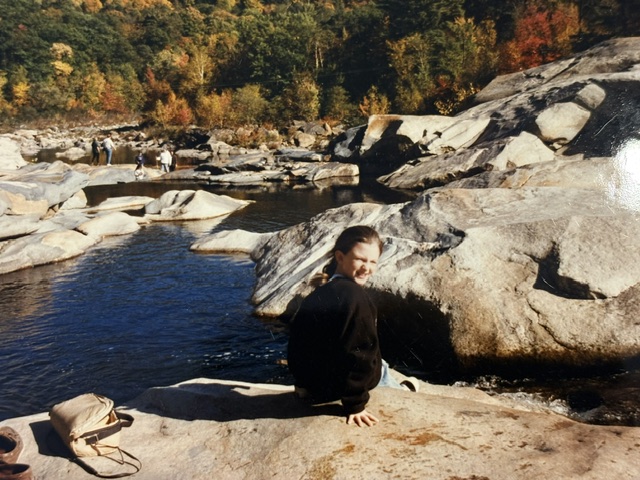
Shelburne Falls is a village shared by the towns of Shelburne and Buckland. More than fifty potholes punctuate the riverbed here, ranging from small depressions about six inches across to cavities nearly forty feet wide. Their varied sizes and shapes make this an unusual feature of the village’s natural landscape.
Despite their familiar name, the potholes were carved by river erosion rather than directly by glacial ice. Turbulent water below the falls created swirling currents that carried stones and sediment into depressions in the rock. As this material circulated, it wore against the surrounding surfaces, gradually deepening and widening the hollows. These processes sculpted hard metamorphic bedrock, including different varieties of gneiss.
Local accounts place the beginning of their formation around 14,000 years ago, following the retreat of the last glaciers. As the river developed its course through the changing landscape, flowing water began the long process of grinding and polishing the exposed rock.
Across the riverbed, broad, gently curved surfaces give way to deeper basins where water collects. The hollows record places where currents concentrated their force, repeatedly turning stones against the bedrock. Their rounded forms are the accumulated result of countless small movements over thousands of years.
The Glacial Potholes offer a way to consider Shelburne Falls beyond its buildings and streets. Here, the river preserves evidence of a much older history. One shaped by changing currents, abrasive sediment, and the gradual wearing away of stone.
Read More From Nancy
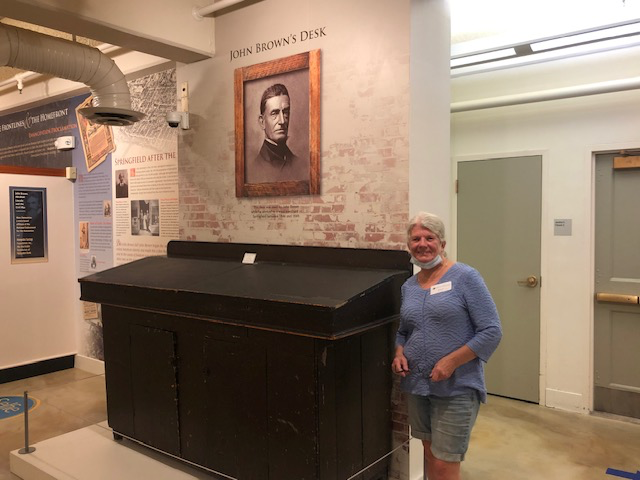
John Brown’s Desk
I stood beside John Brown’s desk at the Lyman and Merrie Wood Museum of Springfield History. It is a large, dark piece of furniture, made for the practical work of keeping accounts and handling correspondence. Brown used it during the years he worked as a wool merchant in Springfield. The museum also identifies it as […]
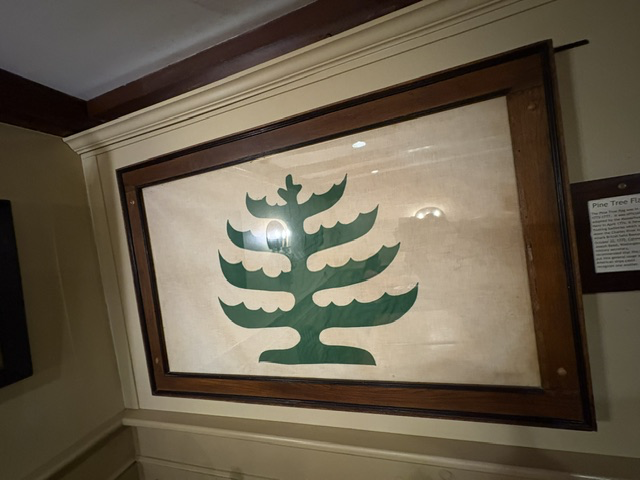
Pine Tree Flag
While enjoying dinner in Sturbridge, my attention was drawn to a large Pine Tree Flag displayed on the wall. It was an unexpected reminder that history has a way of appearing in ordinary places. One of the most recognizable symbols of New England’s role in the American Revolution is the Pine Tree Flag. Although it is […]
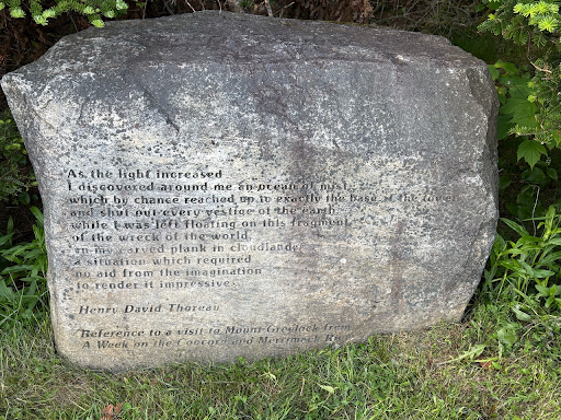
Thoreau’s Night on Mount Greylock
One of the markers on the summit of Mount Greylock preserves the words of Henry David Thoreau, recalling a night he spent here in July 1844. While many visitors come simply to enjoy the view, Thoreau came seeking something more. His journey to Greylock became one of the defining experiences of his early life and […]