Captain Henry Wolsey Bayfield
Walking along the Charlottetown waterfront, it is easy to simply enjoy the view across the harbor. Sailboats move across the water, the opposite shore seems close by, and today we give little thought to knowing exactly where the channels, shoals and underwater hazards are located. A plaque along the waterfront introduced me to Captain Henry Wolsey Bayfield and reminded me that someone first had to chart these waters.
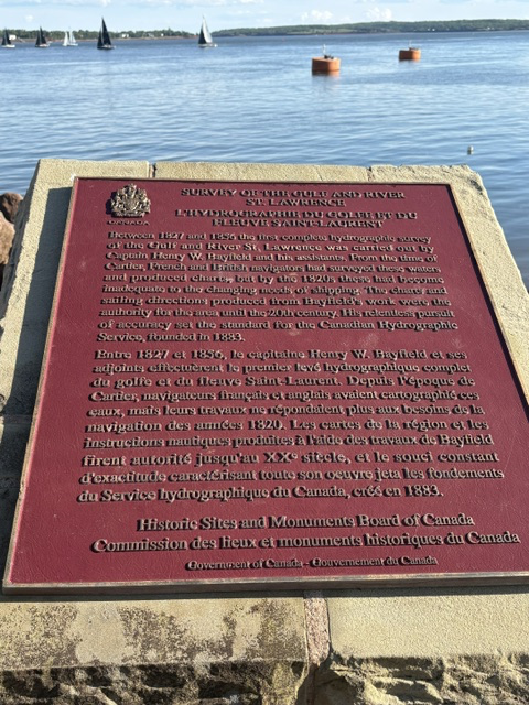
Between 1827 and 1856, Bayfield conducted an extensive hydrographic survey of the Gulf of St. Lawrence and the St. Lawrence River. Working with his assistants, he measured depths, established positions, recorded coastlines and identified hazards to navigation. This was painstaking work, accomplished decades before satellites, electronic depth finders or GPS.
Bayfield was already an experienced naval surveyor. He had entered the Royal Navy as a young boy and later participated in surveying portions of the Great Lakes. His assignment to survey the St. Lawrence placed him in charge of mapping one of the most important, and challenging, waterways in British North America.
Charlottetown became an important part of his life. Bayfield established his headquarters here and made the city his home while continuing his surveying work throughout the region. From Prince Edward Island, his surveys eventually extended through the Gulf of St. Lawrence and along portions of the coasts of Nova Scotia, New Brunswick and Newfoundland.
The charts and sailing directions produced from his work were remarkably accurate. As the plaque explains, they remained useful to mariners into the 20th century. His standards of precision also helped provide a foundation for the Canadian Hydrographic Service, established in 1883.
The harbor was also central to Charlottetown itself. Ships brought people and merchandise to the Island and carried its timber, agricultural products and other goods to distant markets. Accurate charts were therefore about more than navigation. They helped make the maritime commerce upon which communities like Charlottetown depended safer.
Read More From Nancy
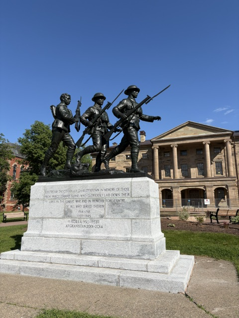
Veterans Memorial
While walking through Charlottetown, we came across this striking monument showing three soldiers moving forward together. With Province House immediately behind it, the memorial sits among the buildings and streets where so much of Prince Edward Island’s political history has unfolded. The monument was originally erected in memory of Prince Edward Islanders who served and […]
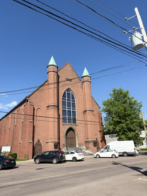
St. Paul’s Anglican Church
While walking through Charlottetown, I photographed St. Paul’s Anglican Church. After seeing the soaring spires of St. Dunstan’s Basilica nearby, St. Paul’s presented a very different architectural presence. Its broad brick façade and Gothic window are comparatively restrained, but the congregation behind this church reaches back almost to the beginnings of British Charlottetown. When Prince […]
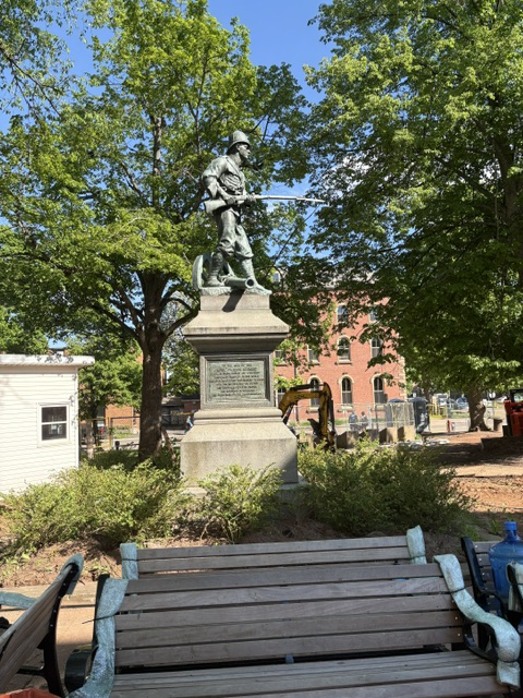
The Soldiers Monument
While walking through Charlottetown, we came across this monument to the men of the Royal Canadian Regiment who served in the South African War of 1899–1902. It immediately caught my attention because it commemorates a war that we rarely encounter on monuments at home in the United States. The reason is simple: the United States […]